
Trace a Northampton Street by Address
Address work in Northampton moves across several custodians. The City Assessor connects a street address to a parcel card. The GIS viewer adds parcel context. The Hampshire Registry of Deeds supplies the ownership instruments, while local permit records and historic directories can add dates and names. None of those sources alone identifies every person who may have lived at an address. Together, they create a more reliable street-by-street trail.
- Normalize the street address with the mailing city and ZIP, then search the City Assessor's TigheBond map by address. Save the parcel ID, situs address, owner name, and any card or deed reference.
- Open the same parcel in the GIS tools. Use Layers and Identify to review the street segment, district context, and adjoining parcel geometry without treating the displayed lines as a survey.
- Search the Hampshire Registry property mode with the address or legal description. Record the newest deed's grantor, grantee, recording date, book and page, document number, and plan references.
- For a public residency lead, ask the City Clerk or Registrars about permissible local voter-file fields. The statewide individual voter tool does not provide a browseable street list, and protected records stay withheld.
- For an earlier household, consult the confirmed 1984-85 Blue Book criss-cross directory or Forbes material, then check the same surname in the alphabetic part of the volume.
Keep a dated note for each result. An owner name, an occupant entry, and a voter-status record answer different questions. The strongest matches share an address, period, and an additional official detail such as a parcel ID or book/page citation.
Normalize Northampton Street Names
Northampton municipal geography includes Downtown, Village Hill, Bay State, Florence, and Leeds. The mailing name may be Northampton, Florence, or Leeds even where city services and parcel records treat the location as Northampton. Florence uses 01062 and city documents use Leeds, MA 01053. Northampton postal material also groups 01060, 01061, and 01063, but the precise delivery or PO-box boundary for the latter two was not established in the research.
Use the USPS ZIP Lookup first to confirm the mailing format. Then use that local ZIP in the assessor or GIS search. Northampton's GIS guidance notes that a plain street string can produce poor global-search results. A mailing ZIP confirms postal formatting only, not a person or ownership claim.
Search Northampton Assessor Fields
The Northampton TigheBond property search accepts a name, address, or parcel ID in its main search box. Its result view can show an ID, complex, unit, owner, and address. Open Parcel Details and then the property card for the assessed-property fields. The card is useful for joining a street label to the parcel identifier used in other records, but it is not a resident roster.
| Assessor field or control | Type | Required | Options and use |
|---|---|---|---|
| Name, Address, Parcel ID | Single text search | At least one practical input | Begin with an owner name, street address, or parcel identifier. |
| Result ID, Complex, Unit | Result fields | Output | Separate a parcel from condominium or unit context where shown. |
| Owner and Address | Result fields | Output | Compare the owner name with the property's situs address. |
| Parcel Details | Link or button | Not applicable | Opens the property-card view under the parcel details. |
| View Details, Print Map, Email Map Link | Map controls | Not applicable | Preserve a map context or revisit the selected parcel. |
The assessor office is at City Hall, 210 Main Street, first floor, and lists 413-587-1200 with weekday hours of 8:30 to 4:30. Counter staff can clarify a field or card question when the public map does not resolve a parcel.
Northampton Street Record Terms
Several labels in an address-by-street search look alike but point to different things. Treating them as separate prevents a correspondence address from being mistaken for a residence or a map line from being mistaken for the deed description.
- Parcel
- A defined tax-assessment unit, identified by the assessor and shown with a card, map outline, and property details.
- Situs address
- The physical address of the parcel. It can differ from the owner's mailing address.
- Legal description
- The deed's conveyance description, which may use metes and bounds, a plan and lot, or a book/page reference rather than a familiar street label.
- Criss-cross directory
- An address-ordered directory section used to move from a street address to an occupant entry for the volume's year.
A sampled 225 State Street card showed a Northampton situs but a different owner mailing address. That contrast is a practical reminder: mail goes to an owner correspondence address, while the situs identifies the parcel. Neither field proves that every household member is present.
Map a Northampton Street Segment
The City's GIS public-information page links the public mapping resources. In the map interface, About describes sources, Layers controls the stack and sublayers, and Identify opens details for a clicked feature. Some layers are scale-dependent, so a layer may appear only after zooming. Search with the local ZIP, then use the parcel and street context to avoid a misplaced global result.
For a block-level check, the map offers Abutter Distance, Adjacent, Find Abutters, Clear Abutters, Add Parcel, Remove Parcel, Print Labels, and Export List. Those controls help select parcels around an address. The City cautions that public property lines are not authoritative for conveyances or accurate measurement. A professional surveyor remains the route for a boundary determination.
Northampton Street Records by Address
Each address-keyed source has a narrow job. The assessor card provides property attributes and owner mailing data. The map supplies parcel context. Registry documents show recorded instruments. Permit files can show project activity. Historical volumes can place a name at an address in a particular year. The table keeps those distinctions visible when following a Northampton street directory trail.
| Address record | Custodian | Useful fields | Access route |
|---|---|---|---|
| Assessor parcel card | City Assessor / TigheBond | Owner, mailing address, situs, valuation, characteristics, sketch | Name, address, or parcel-ID search on the public map |
| GIS parcel view | City GIS / ArcGIS | Geometry, districts, layers, adjoining parcels | Address search, Layers, and Identify tools |
| Recorded land | Hampshire Registry of Deeds | Grantor, grantee, instrument, date, book/page, legal description | Property, name, book/page, document, or date modes |
| Permit history | Northampton Planning and Building | Address, record ID, plans, files, application history | OpenGov Locations or Records, with a legacy route |
| Local voter file | City Clerk / Registrars | Permissible public name, address, party, and status fields | Ask for current format, fee, estimate, and lawful fields |
| Historic directory | Forbes, Google Books, LOC guide | Name, occupation, address, reverse entries where present | Year-specific volume or Hampshire Room research |
A parcel ID is the best bridge between local property tools. A street name alone can change in spelling or appear without an older deed-index field. For history rather than a current parcel question, the Directory Book follows the confirmed local volumes in more detail.
Follow Northampton Deeds Along a Street
The Hampshire Registry search instructions show recorded-land name, document, book, property, and recorded-date routes. Start with the parcel address or legal description where indexed. In the newest purchase document, the current owner is normally the grantee and the earlier seller is the grantor. Search the seller as a grantee in an earlier transaction, then repeat while preserving book/page and legal-description references.
The Registry's recorded-land search instructions show the property, name, document, book, and date paths used to move beyond a street label.
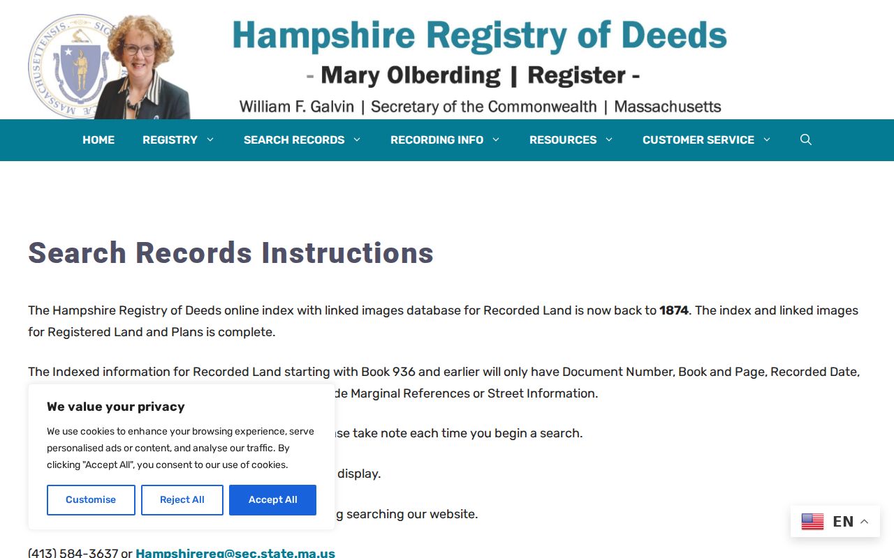
Books 936 and earlier do not include street or marginal-reference fields in the index segment. For pre-1928 material, book/page and Unindexed Property Search, books 1 through 1024, are the practical online image route. Registry staff, deed books, microfilm, and Forbes land reels are useful fallbacks when the name index stops short.
Check Northampton Permit Addresses
Northampton's OpenGov permits supply a separate address trail. Post-March 2023 records can be searched by street address under Locations or by record ID under Records, and Files can open plans where they are available. Older material uses a linked legacy page. Online permitting began June 29, 2026, so the access path for a project depends on the date of the record.
A permit can date an application, inspection, addition, or plan submission. It does not prove a sale date or identify every resident. For a record not available through a direct portal, the City public-records process can be sent to the City Clerk when the appropriate department is uncertain. The form instructions call for a written response within 10 business days and describe the City's estimate process for chargeable work.
Request Northampton Street Voter Fields
The Massachusetts Voter Registration Search is an individual tool. It requires first name, last name, date of birth, a five-digit residential ZIP, and an agreement checkbox. A match can return registration or pre-registration status, active or inactive status, polling location, and elected officials. Under G.L. c.51 §64, it does not turn an address into a public browseable household list.
Northampton's annual street list is a city census used for continued residency and voter-list maintenance. A historical entry establishes residency for the relevant census year, not current occupancy. For public local-file fields, request the permitted format and production details from the City Clerk or Registrars. Protected voters, contact details, and other withheld categories remain outside the public result.
Read Northampton Addresses in Reverse
A reverse or criss-cross volume begins with an address instead of a surname. The confirmed late-twentieth-century local anchor is the Northampton, MA & vicinity Blue Book for 1984-85. Search the address in that portion first, then find the occupant surname in the same volume's alphabetic section. The second entry may add an occupation or clarify a spelling.
Forbes documents Coolidge research using directory years from 1895/96 and 1896/97 through 1932 to resolve address questions. The confirmed record does not establish a continuous directory run. Keep the volume year beside every extraction, and avoid assuming that a missing name means a household moved. A name may be absent, abbreviated, or indexed under a business or a variant spelling.
Use Northampton Street Valuation Reels
Forbes Library's Hampshire Room provides an in-person bridge over gaps in online street records. Reel 146 contains Northampton tax assessments, polls, and estates from 1703 to 1884. Reel 147 covers tax-assessor material from 1799 to 1881, while reel 188 has valuation lists from 1861 through 1910. These are taxpayer, owner, and value sources, not complete occupant lists.
The Hampshire Room is at Forbes Library, 20 West Street. Its listed Thursday, Friday, and Saturday hours are 10:00 to 2:00; appointments are recommended. Ask about the relevant reel or book before visiting. Historical entries become more dependable when a valuation line, directory entry, and deed reference point to the same address and period.
Northampton Street Directory Limits
A Northampton street directory cannot show every occupant, guest, non-owner household resident, utility subscriber, delivery customer, or DMV address. The assessor lists ownership and assessment information, not a household census. The public voter lookup is limited, and confidential or protected voter records are withheld. A deed proves a recorded instrument or ownership transfer, not who occupied the parcel on every date.
When details conflict, return to the custodian record and compare dates. A city public-record request, a Registry book/page image, or a Forbes microfilm volume can resolve a gap more responsibly than treating one index result as final.