
Northampton ZIP Code Directory Coverage
The Northampton ZIP code directory has five documented postal groupings. They are not five municipal districts. Downtown and the main Northampton mailing area use one grouping, while Florence and Leeds carry their own postal names in city documents. Two additional Northampton groupings appear in USPS material, but the research did not find their exact delivery or post-office boundaries. Verify an individual address rather than assigning a neighborhood from a ZIP alone.
| ZIP | Documented area or mailing name | Post office or station | Local caution |
|---|---|---|---|
| 01060 | Northampton core, downtown, and main mailing area | USPS Northampton, 37 Bridge Street | Confirm each address with USPS. |
| 01061 | Northampton grouping in USPS material | Exact delivery or PO-box boundary not located | Do not assign a village without verification. |
| 01062 | Florence village | Florence station, 123 Main Street | Florence mailing name differs from municipal Northampton. |
| 01063 | Northampton grouping in USPS material | Exact delivery or PO-box boundary not located | Use address-level USPS confirmation. |
| 01053 | Leeds | Facility detail not located in inspected source | Leeds is municipal Northampton with its own mailing name. |
USPS archived material groups 01060, 01061, and 01063 under Northampton. City records use Florence 01062 and Leeds 01053. No official ZIP split year, population-by-ZIP figure, exact map for 01061 or 01063, or confirmed PO-box-only designation was located. That absence matters: a ZIP is postal routing geography, not proof of a city boundary or household list.
Northampton USPS Mailing Search
Use the USPS ZIP Lookup before carrying a postal label into a local record search. It offers a by-address mode, a city-and-state mode, and a cities-by-ZIP mode. The address result validates a mailing format. It does not confirm that a named person or business occupies that address. For Northampton searches, try the documented mailing city, then Florence or Leeds when the address and local records point there.
| USPS field or tab | How it is used |
|---|---|
| By Address | Address-to-ZIP path for a physical mailing address |
| Company | Optional field in the address route |
| Street Address | Required address field |
| Apt/Suite/Other | Optional secondary designator |
| City and State | Required mailing city and Massachusetts selection |
| By City and State | Finds ZIP results from the selected city and state |
| Cities by ZIP | Shows recognized mailing-city names for a five-digit ZIP |
The USPS Northampton location record identifies the main office on Bridge Street and gives the local postal context for the core area.
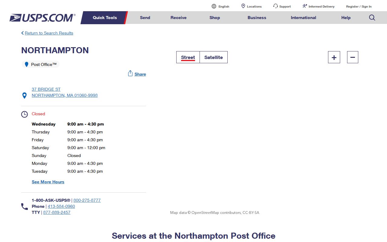
The main office record is useful for postal context, but the address lookup remains the step that tests a specific mailing address. Keep the returned format with the search date when matching it against a property card or a historical document.
Search a Northampton ZIP Code
ZIP information narrows an address problem, not a person search. The state voter tool requires the five-digit residential ZIP for one individual result, but it does not return a browseable ZIP-wide roster. TigheBond and the GIS are the local parcel routes: enter the full address with the postal information, confirm the returned parcel ID, and use that ID to keep a similarly named street or owner from being confused with another record. The registry’s property and legal-description search is not a dependable ZIP-wide resident list.
- Check the full mailing address in USPS and record the returned city and ZIP format.
- Search the TigheBond Northampton parcel map by address. Open Parcel Details and save the parcel ID, owner, situs, and mailing fields.
- Use the Northampton GIS public portal to identify the parcel and its local layers. Include the local ZIP in address search because the GIS search is global.
- If a particular registered voter must be checked, use the state’s individual search with the exact name, date of birth, and residential ZIP. Ask the City Clerk or Registrars about any lawful local-file request.
Once the postal result has narrowed the work to one street, use the Northampton Street Directory for the address-keyed trail through parcels, deeds, permits, and historical reverse directories. Postal routing cannot replace those local records.
Northampton Parcel Search by ZIP
TigheBond presents one text search for name, address, or parcel ID. A result can show an ID, complex or unit context, owner, and address; Parcel Details opens the property card. That card distinguishes the situs address, which is the parcel location, from the owner mailing address. The distinction is important in a ZIP-based search because the owner may receive correspondence somewhere else and may not be the person living at the parcel.
The GIS portal has About, Layers, and Identify functions. Its map layers can be scale dependent, so a layer may appear or disappear as the view changes. Map lines are informative but are not a legal survey. For a boundary question, use a professional land surveyor and the authoritative record route rather than measuring from the public map.
Note: A parcel ID such as 24D-145-001 follows the format returned by TigheBond, not a universal citywide lot convention.
Florence ZIP and City Names
Florence is one of Northampton’s recognized villages, but it uses Florence MA 01062 in city records and postal context. This is a practical records-geography issue. A municipal department, assessor map, or permit record may use Northampton, while an address normalization result or older directory line uses Florence. Save both the municipal city and the postal city when they differ, rather than replacing one with the other.
The Florence station is listed at 123 Main Street, Florence MA 01062-9998. That station detail supports the local postal label, but it does not establish the boundary of every Florence delivery route. Use USPS for the exact address, then compare the parcel inside the city’s GIS and assessor systems.
Leeds ZIP and City Names
Leeds is also municipal Northampton, yet city documents use Leeds MA 01053. The research specifically identifies a Leeds label for 85 Reservoir Road and a Leeds school address on Florence Street. That combination makes Leeds a clear example of why a mailing city should not be treated as a separate municipality in a local records search.
Facility details for the Leeds postal route were not located in the inspected material. Keep the address exactly as USPS returns it, while using Northampton municipal sources for property, permits, assessment, and GIS questions. This preserves the source’s geography and avoids losing a record because one database expects Leeds while another expects Northampton.
Northampton ZIP Boundaries
Postal boundaries and Northampton city limits do not match. Florence and Leeds remain within Northampton’s municipal service geography while using distinct mailing conventions. The city’s five recognized villages are Downtown, Village Hill, Bay State, Florence, and Leeds, but a ZIP does not map one-to-one to those places. The published research did not identify an official postal boundary map for 01061 or 01063, so a result for either grouping needs address-level USPS verification before it is used to select a municipal record.
Postal result, parcel result, legal record. Keep all three when they differ. USPS answers mailing format, the assessor identifies the parcel, and a deed’s legal description identifies the land conveyed.
When a record points to a street rather than a full address, compare the source date and spelling before applying a modern postal format. This is especially useful for a family-history search, where a directory, census, deed, or obituary may record the place in a different local form.
- ZIP and ZIP+4
- A five-digit ZIP identifies a postal delivery area. ZIP+4 adds a more specific delivery segment, such as a block or group of addresses.
- PO-box ZIP
- A ZIP used for post-office boxes rather than a general delivery area. No such designation was confirmed for the Northampton groupings in the inspected research.
- Unique ZIP
- A ZIP assigned to one institution or recipient. No unique Northampton ZIP was confirmed in the inspected material.
- Carrier route
- A postal delivery sequence used to route mail. It is not a city-limit, parcel, or resident boundary.
Northampton Historical Address Checks
Old directory and census references should keep the city or village wording printed in the source. Postal labels can change in use even when the property remains within Northampton. A current USPS result is therefore a tool for interpreting a present mailing address, not a replacement for a historical address line. Pair an older directory entry with a deed book and page, parcel legal description, or Forbes Library record when the street wording is unclear.
Forbes material supplies several useful local comparisons: city-directory examples from 1868–69, the Price and Lee directory of 1883, and the Northampton and vicinity Blue Book for 1984–85. Those volumes are not a continuous address list. A directory entry can identify a name, occupation, or address for its publication year, while a federal census records a household at its own enumeration date. Compare the year, the street spelling, and any village label before carrying an old address into a present-day postal search.
The USPS lookup interface includes address, city-and-state, and city-by-ZIP search modes for that final formatting check.
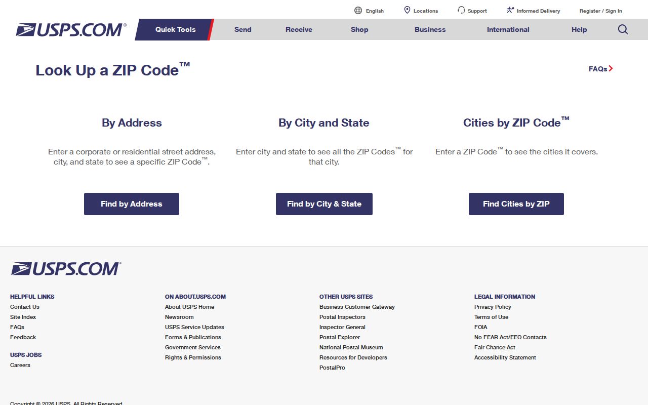
Use a verified postal format to find the correct modern parcel, then leave the historical source spelling intact in notes. That approach keeps municipal geography, postal geography, and the history of the address from being collapsed into one label.